Last Update: August 18, 2015 |
About
Voter Focus provides—via a separately purchased interface—the ability to import street-segment, precinct, and district assignments, as well as census block and tract information from the county GIS system into the voter registration database. We refer to this feature as the Generic GIS Interface, because it is not limited to a single GIS vendor. It is designed for use by counties using Esri ArcInfo, Maptitude, or similar GIS systems to maintain their street maps, district boundaries, precincts, and other geopolitical information.
The Generic GIS Interface has two mechanisms for sharing data between the voter registration database and the GIS system:
An export of voter information to the GIS system.
An import of data from the GIS system into the voter registration database.
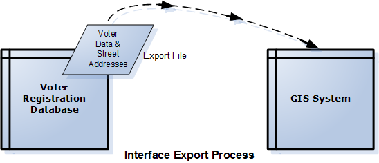
EXPORT of a file of voter information
including demographic information (age, gender, race, party preference) and residential street addresses, from the voter registration database. This file can then be imported into the GIS system for geocoding of voter addresses to map points. See Generic GIS Interface-How to Export Data from the Voter Database for a GIS System for instructions.
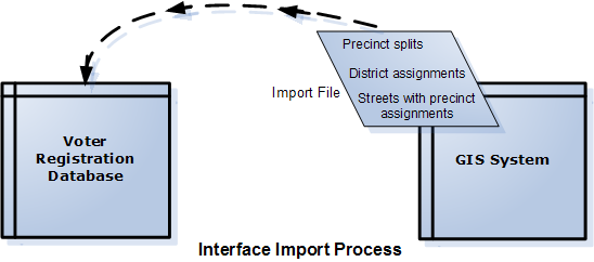
IMPORT of a file from the GIS system into the voter registration database
This operation updates the following information in the voter registration database. See Generic GIS Interface-Importing GIS Data into the Voter Registration System for more information.
Precinct splits.
Districts that are not already defined the voter registration system.
District assignments to precincts and precinct splits.
Street segments and their assignments to precincts and precinct splits
Census block and tract data.
During the time between the export and import operations, the county's district, precinct splits, street segments, and census block and tract IDs are updated on the GIS system. Once this is done, the data can then be imported back into the voter registration database where voters affected by updates to the GIS system are reassigned to their correct new precincts.